Berthoud Lewis Valley Community
Lewis Valley is rooted in the belief that thoughtful planning begins with transparency, open conversation, and respect for the community it will become part of.
As the vision for Lewis Valley continues to take shape, we understand there are important questions surrounding the land, open space, trails, history, environmental planning, and the future of this area of Berthoud.
Below, we’ve gathered answers to some of the most common questions about the project to help provide clear, factual information about the vision, planning, and long-term goals behind Lewis Valley.
Understanding
the Lewis Valley Plan
Q&A
LOCAL PLANNING + INFRASTRUCTURE
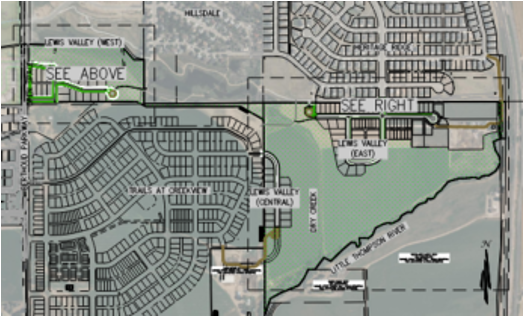
How does the project connect to Berthoud trails?
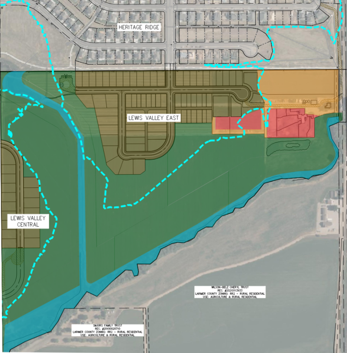
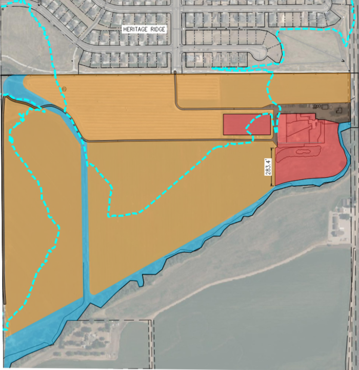
The site plan was designed to connect into Berthoud’s regional trail system and help complete a missing trail connection along the Little Thompson corridor.
What traffic studies have been completed?
A traffic study was completed by Kellar Engineering.
How will traffic be affected?
According to the traffic study, nearby intersections and roadway improvements are expected to adequately support projected traffic associated with the development.
Why was Lewis Valley West approved for residential use?
The Town’s Future Land Use Map identified portions of the area for future planning consideration. The project proceeded through the Town review and approval process.
How will the project impact local schools?
According to Thompson School District estimates, the project is anticipated to add approximately 46 students.
OPEN SPACE + ENVIRONMENT
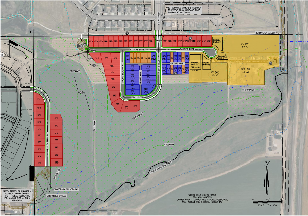
How much open space is being preserved? The plan preserves approximately 68 acres of open space, greenway, trails, and natural areas, about 65% of the overall project.
Are homes being built in the floodplain? No proposed homesites are located within the 100-year floodplain.
What ecological studies have been completed?An Ecological Characterization Study was completed by Wildlands Consulting.
See Study Summary here
Were wildlife impacts evaluated?
The ecological study found no mapped Colorado Parks and Wildlife high-priority habitat areas in the development areas, and no expected impacts to federally listed or special-status wildlife or plant species.
Why is additional grading or fill being brought onto the property?
Areas outside the floodplain require grading for roads, drainage, and infrastructure improvements associated with development.
What will happen to the preserved open space?
The Town has discussed incorporating portions of the open space into the regional trail system along the Little Thompson River corridor.
HISTORICAL PROPERTY + BUILDINGS
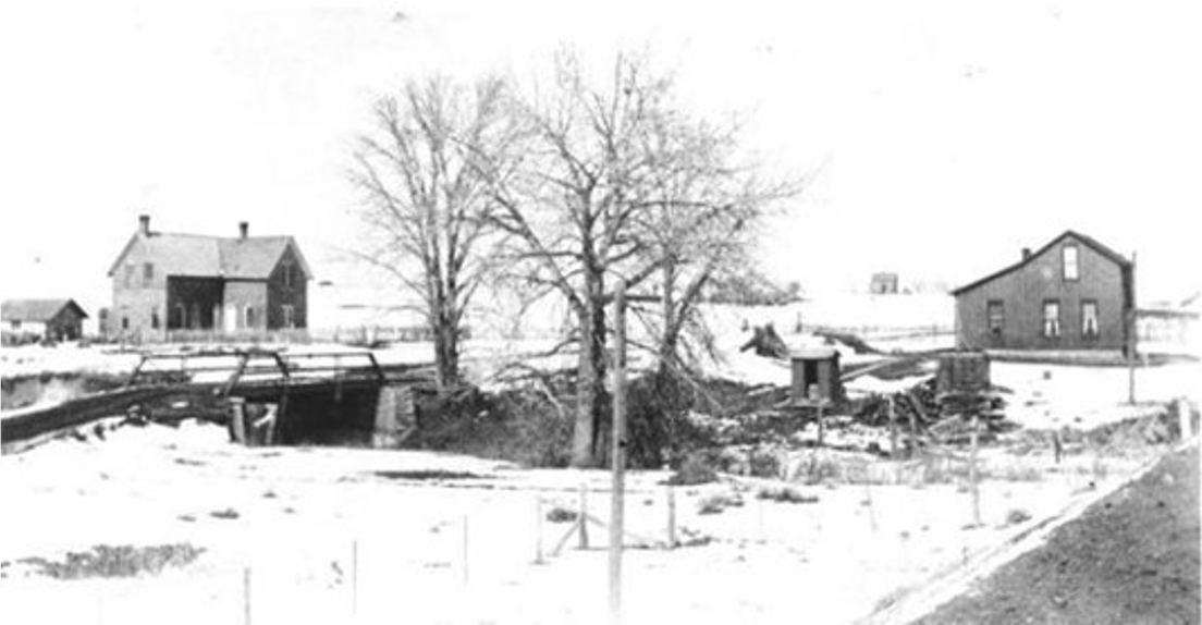
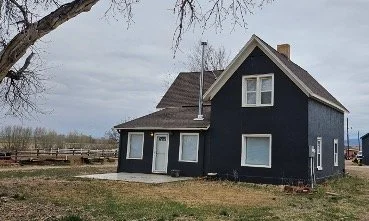
Are there buildings with historical significance on the property?
Yes. Several structures on the property are connected to Berthoud’s early agricultural and homesteading history.
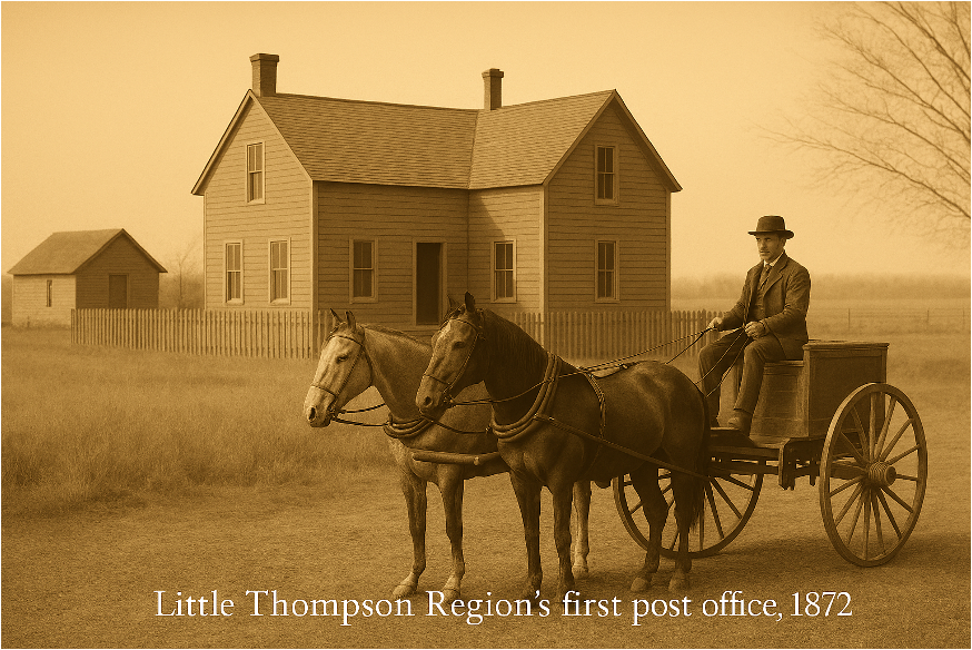
Who was Lewis Cross?
Lewis Cross is recognized as one of Berthoud’s founding settlers. His residence on the property also served as the area’s first post office.
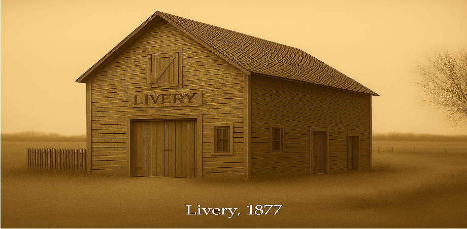
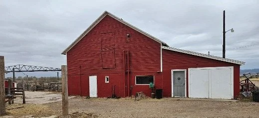
What is the historical significance of the barn?The barn originally served as a livery where travelers boarded horses and gathered supplies during Berthoud’s early development.
What is planned for the historic buildings?The buildings are intended to remain within one of the agricultural lots, with the hope that future ownership preserves and potentially repurposes them for community benefit.
LOWER DENSITY PLANNING
Is this considered a high-density development? No. The project consists entirely of single-family detached homes and follows a lower density planning approach.
How many homes are proposed?
The Lewis Valley plan proposes 109 homesites vs the 364 that could be developed.
Could more homes potentially be built on the property?
Alternative development approaches could potentially allow up to 364 homesites on the property.
Why was a lower density approach chosen?
The plan was designed to preserve more open space, provide varied lot sizes, and create greater separation between homes, trails, and natural areas.
What types of homesites are included?
The project includes a mix of suburban residential lots and larger agricultural lots.
How much land is planned for residential development?
Approximately:
68 acres open space (65%)
9 acres agricultural lots (9%)
27 acres residential development (26%)
The Facts about Lewis Valley
68 acres preserved as open space and greenway
Approximately 65% of the project planned as open space
Only 109 proposed homesites
Up to 364 homesites could potentially be developed under alternative planning approaches
No proposed homes located within the 100-year floodplain
NO METRO DISTRICT resulting in longterm affordabilitySingle-family detached housing only
Homeowner Association managed
Mix of suburban and agricultural lot styles and sizes
Lower density planning approach
Regional trail connectivity incorporated into the site plan
Designed to help complete a missing trail connection along the Little Thompson corridor
Ecological study completed by Wildlands Consulting
No mapped CPW high-priority habitat areas identified on the development
Traffic study completed by Kellar Engineering
Majority of development traffic connects directly to roadways with high traffic capacity.
Existing and planned roadway improvements expected to supports projected traffic needs
Estimated impact to Thompson School District approximately 46 students
Historic homestead and livery structures planned for preservation
Lewis Cross residence and original post office remain on the property
Conversations are underway about opportunities for local sculptural artwork throughout the project
Concept discussions include a potential Veteran Memorial Park on the northwest portion of the property
Open space areas intended to support future community connection, recreation, and preservation opportunities
Coordinated through the Town of Berthoud planning and approval process
Planning focused on balancing open land preservation with future community growth